• Skip to primary navigation
  • Skip to main content

CARNM

Commercial Association of REALTORS® - CARNM New Mexico

  • Property Search
    • Search Properties
      • For Sale
      • For Lease
      • For Sale or Lease
      • Start Your Search
    • Location & Type
      • Albuquerque
      • Rio Rancho
      • Las Cruces
      • Santa Fe
      • Industry Types
  • Members
    • New Member
      • About Us
      • Getting Started in Commercial
      • Join CARNM
      • Orientation
    • Resources
      • Find A Broker
      • Code of Ethics
      • Governing Documents
      • NMAR Forms
      • CARNM Forms
      • RPAC
      • Needs & Wants
      • CARNM Directory
      • REALTOR® Benefits
      • Foreign Broker Violation
    • Designations
      • CCIM
      • IREM
      • SIOR
    • Issues/Concerns
      • FAQ
      • Ombuds Process
      • Professional Standards
      • Issues/Concerns
      • Foreign Broker Violation
  • About
    • About
      • About Us
      • Join CARNM
      • Sponsors
      • Contact Us
    • People
      • 2026 Board Members
      • Past Presidents
      • REALTORS® of the Year
      • President’s Award Recipients
      • Founder’s Award Recipients
    • Issues/Concerns
      • FAQ
      • Ombuds Process
      • Professional Standards
      • Issues/Concerns
      • Foreign Broker Violation
  • Education
    • Courses
      • Register
      • All Education
    • Resources
      • NMREC Licensing
      • Code of Ethics
      • NAR Educational Opportunities
      • CCIM Education
      • IREM Education
      • SIOR Educuation
  • News & Events
    • News
      • All News
      • Market Trends
    • Events
      • All Events Calendar
      • Education
      • CCIM Events
      • LIN Marketing Meeting
      • Thank Yous
  • CARNM Login
  • Show Search
Hide Search

Archives for April 2021

The Best Recipe for 15-Minute Livability

April 30, 2021 by CARNM

A mix of strategies, including adaptive reuse and data analysis are imperative when creating the neighborhood for everything.

I grew up in Tipton, Iowa, a town of around 3,000 people about 25 miles from Iowa City — home to the University of Iowa. The seat of government for Cedar County, Tipton was the focal point for surrounding, even smaller villages. My little burg, it seemed, had nearly everything we needed. (Culture and Big Ten sporting events were only a 30-minute drive away.)Man wearing a mask in a grocery store reaching the shelf

The weekly newspaper that my father edited and later purchased was less than a 10-minute walk from our home. The town’s two grocery stores were only a few blocks away from his office, as were the library, two pharmacies, men’s and women’s clothing stores, a dry cleaner’s, a shoe repair shop, several doctors’ offices and my favorite as a kid, a “Dime Store” with its dazzling display of penny candies. Three churches were all within a short walk.

This was the 1970s and our community was pretty much self-contained, with the elementary school a four-block walk from my family’s house and the combined junior high/high school a whopping nine-blocks away. The big community park was also about the same distance.

I left for college in Colorado after high school and eventually ended up working for a newspaper in San Diego, living in a suburb and having to drive just about everywhere for anything. It never felt right.

Walkable neighborhoods where most basic needs are within a 15-minute walk are in high demand.

Fast forward several decades with more than a few moves in between. I’m now back in the Midwest, in Middleton, Wisc., — on the northwest edge of Madison and only three blocks from a grocery store, a cafe, barber shop and dry cleaner in the Middleton Hills development. The town’s library, schools, swimming pool, tennis courts and other amenities are only a short bike ride away. My commute to my basement office takes about 20 seconds. I’m in heaven.

Chris Zimmerman, Smart Growth America’s vice president for Economic Development and director of the Governors’ Institute on Community Design, says these walkable neighborhoodsPeople walking on sidewalks alongside outdoor restaurant tables at the Village in Shirlington, VA where most basic needs are within a 15-minute walk are now in high demand. He lives on the edge of one, not far from the Village at Shirlington, a downtown built on the former Shirlington Shopping Center in Arlington, Va.

And while my town grew up organically, Zimmerman’s neighborhood and others like it are being created by developers and city planners using data analysis and other techniques to ensure that they will be successful.

Creating Mixed Use on Parking Lots

The Federal Realty Investment Trust — which has a mission of delivering “long-term, sustainable growth through investing in densely populated, affluent communities where retail demand exceeds supply” — was the company behind the Shirlington project.

Around a decade-and-one-half ago, it turned what Zimmerman said were “mostly parking lots” on the 26-acre Shirlington site into a mixed-use center with a grocery store, movie theater, county library, post office and restaurants. It also included a transit center, which Zimmerman said is essential because as many as 30 percent of the U.S. population doesn’t have drivers’ licenses. Moreover, he noted, many young people don’t want to own cars and would rather use ride-sharing services or rent vehicles on occasion.

Zimmerman said the redeveloped town center also has townhouse, apartments, condos and some rental apartments for needed density and to serve the needs of those who don’t want to own a single-family residence.

“I don’t live in the town center, but there are a lot of people who do and can walk right downstairs to do their shopping and run other errands to meet life’s essential needs,” explained Zimmerman, who said he lives in a nearby neighborhood that grew up “before everything was totally car-oriented.”

Neighborhoods are being created by developers and city planners using data analysis to ensure that they will be successful.The Shirlington Library front entrance and outdoor area in Alexandria, VA

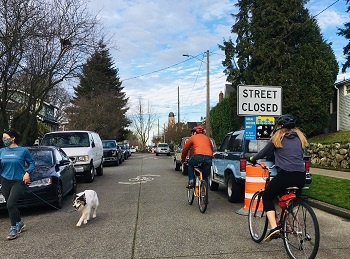
“There are a lot of communities out there that are fundamentally walkable and fairly dense, with single-family houses fairly close together because they were built in the 1940s and have sidewalks.

“They also had corner stores and things like that. But the corner shops and the mid-sized grocery stores of around 10,000 square feet closed over time and now shopping is further away because a bigger center opened up a couple of miles out.”

Zimmerman said the distance from his home to the Village at Shirlington is about a mile, which takes him around a 20-minute walk depending on the pace.

And while that isn’t an everyday walk, come warmer weather and the diminishing worries of COVID, he said he and his wife plan to stroll downtown to have dinner, see a movie and then “walk back to burn off the extra dessert we had,” he said. “Or, if we are feeling lazy, we can catch a bus or a cab.”

A minority of the country now lives in 15-minute neighborhoods, where you wouldn’t need a car and you’d be fine without it being terribly burdensome.

“There is a lot of grey, however, where there is some walkability and there are certain things you can get. But there is also a whole range of things you can’t reach reliably without taking a car,” Zimmerman said.

“There is a big chunk of the country that are older suburbs or towns that used to be more walkable, because that was how we built everything back then. Now, though, a majority lives in late 20th Century suburbs where you have a monoculture of single-family housing and you can’t do much without an automobile.”A street with townhouses in Shirlington, Alexandria, VA

Data can show how many people live within the “walkshed” of the location being redeveloped.

Zimmerman said much of the work he does involves data analysis, figuring out where and how walkable, mixed-use projects can be built.

Often, that means redeveloping or replacing malls, altering zoning rules and making other changes.

According to the NATIONAL ASSOCIATION OF REALTORS® Research Groups’ 2020 Case Studies on Repurposing Vacant Retail Malls: “Vacant malls contribute to urban decay, declining property values, and lower tax revenues. Because of these adverse effects, it is important that vacant retail stores are repurposed for other uses. …

“Careful planning and market assessment of the best uses of the vacant malls are essential. The best use is different for each area. …”

Ensuring Successful Adaptive Reuse of Malls With Data

“Malls are dying or dead all over the place,” Zimmerman said. “We have examples of them being converted to other uses and in some cases being remade entirely, like in Lakewood, Colo. It had one of the biggest indoor shopping malls in the country in the 70s and 80s and it was a big chunk of the tax base in the county west of Denver.

“It went from being really profitable and providing a lot of the sales tax base for the county to going bust in a fairly short period of time. But they took it down and turned the big site of around 100 acres into gridded downtown that they created.”

Zimmerman said data can show how many people live within the “walkshed” of the location being redeveloped. “We use a lot of GIS (geographic information system), which gives you the data you need with layers associated with the geography. If I change the boundaries, I can tell how many people live there, how many have certain incomes or other characteristics we have in the data base.

“There are also specific geographies created within the GIS that allow you to analyze the differences and the impact on commercial real estate in walkable urban areas, basically walkable places versus the car-dependent, car-only areas.”

In most metro areas, he said only 2 to 5 percent of the land is walkable urban.

Analysis shows how much more valuable walkable land is than these drive-only places.

“But it carries a huge, disproportional amount of the value,” he said. “When you do the analysis, you really see how much more valuable walkable land is than these drive-only places, where you are talking about the bedroom community, shopping centers and office parks. With this mapping, for example, you see that four percent of the land area in Boston is walkable, but it has 40 percent of the value.

“That analysis tells you where money wants to go, where there’s return on investment. With a lot of communities, we work with them, looking at their sources of revenue and expenditure with a net impact fiscal analysis. We say if you have new development, depending on where it goes, it will contribute differently to your costs on the one side and the revenue on the other.”

Data Underscores the Importance of Mixed-Use Development

Zimmerman said data also shows that single-family neighborhoods that are spread out typically cost more than denser areas to serve because of the costs of putting in infrastructure.

“You annex a bunch of land, put in these high-end developments and you think, ‘great, it’s going to be for affluent people who pay a lot of taxes.’

“But when you run the streets there, it’s a lot of road relative to the taxpayer. And then underground you have to lay the pipes for water and sewer and stormwater. You have to run fire trucks out there and police cars and school buses to pick up kids and trash trucks and all that. When you calculate all this, it turns that many of these very wealthy hoods are often paying less than it costs toA shuttlebus in Lakewood, CO dropping off a passenger serve them.

“That’s good data to have which communities often don’t use. They just assume it’s going to produce a lot of tax revenue and a private developer is going to do this and that’s great. So, location matters and data can show that.

If we put things within a quarter mile of people, they’re likely to walk.

“The relative value of different land varies a lot according to factors that are directly related to this concept of 15-minute cities. It is essentially a gradient built on the fact that there is a fundamental human propensity for walking, which is our basic way of locomotion. It says if we put things within a quarter mile of people, they’re likely to walk.”

But if they are beyond half a mile, they may balk.

“People are individuals, of course, but over an entire population, many are going to do 75 percent of their trips by foot within a quarter mile and that has an implication for the value of the real estate that you’ll be walking over.

A lightrail train in Lakewood, CO

“That value depends on the mix of uses,” he said.

“For instance, you may put in a train station that is within convenient walking distance of my house, which may get me to my job 30 minutes away. I’ll probably go by foot back and forth to get on the train.

Intensely valuable land happens when you mix the uses and have a level of density.

“But if you have a mix of uses there with shops and services, I can stop by and drop off this or pick up that. So, there is now less reason for me to get in the car to go somewhere else to shop. But it also means you’ll have intensely valuable land.That’s what happens when you mix the uses and have a level of density, which makes the transit more viable.

“This plays out in ways that affect the economy, health, climate change, equity, all those things based on having mixed-use development within walkable distances and a good, healthy environment that supports that lifestyle.”

Zoning Analysis When Creating the 15-Minute City

Cindy McLaughlin, CEO of Envelope City, uses a different kind of data to help create 15-minute neighborhoods. Envelope’s 3D urban mapping software helps real estate professionals visualize and analyze development opportunity under the constraints of zoning.

Working primarily in New York City, she said her company has taken the city’s wildly complex, 4,300-page zoning code and built it into mapping software that can also aid nonprofits and community organizations.

People sunbathing along the river bank in NYC

“The idea is to immediately be able to analyze, see and run scenarios on development potential under the spacial constraints of zoning. The zoning code here is this incredibly technical, very specific block by block document and it takes years to build it into software the way we’ve done it.”

McLaughlin is a fan of Carlos Moreno, the urban planner and futurist at the Sorbonne University in Paris who is proselytizing the 15-minute city concept, which advocates turning urban areas back to their earlier roots.

“The idea is to take cities out of the business of mass transit, getting people from one end to the other in a daily commuter rhythm and instead move toward a city of villages,” she said.

“That concept works really well in cities like New York or Boston or Philadelphia that are pre-industrial. It gets harder for newer cities that were built to house people outside the center and have them commute in to their work. The infrastructure of the whole city is built differently, but it can be done.”

McLaughlin said Envelope City was the creation of SHoP Architects, which spent seven years building a prototype for Manhattan in collaboration with Sarah Williams, an urban planning and technology professor at MIT. McLaughlin described Williams as “one of the world’s leading mapping experts.”People shopping at a farmers market in NYC

“They spun Envelope out in 2015 when they had a good enough prototype to be useful,” she said. “I came on at that point and since 2016, I’ve brought a technical team around me and we’ve been continuing to evolve, layer more and more relevant rules and expand the geography. We went from Manhattan through all of the five boroughs.”

McLaughlin said her company is focused on the accuracy of the underlying data. It charges $1,500 for a standard single-lot report with a two-day turnaround and can do a whole neighborhood for a project price.

“We built our own survey-grade parcel maps and we corrected the zoning boundaries that the city puts out, we did our own wide- and narrow-streets database because knowing whether you are on a wide or narrow street is a factor in NYC zoning, which helps you determine development potential and we’ve continued to evolve the underlying model so it is now incredibly correct and very detailed.”

Zoning needs a local expert to help with the complexities and understand the area deeply.

She said her company can add additional data to its 3D, SIM City-like maps.

“We can layer on data like where are all the fresh food establishments, the schools, parks, grocery stores for fresh food, offices, light industry and where’s the transit to figure out residents’ daily commutes and what kind of development should be encouraged.”Kids playing in a basketball court in New York city

Answering Complex Questions to Ensure Viable Development

Though Envelope City focuses on New York, she said her model could be adapted to other parts of the country.

“But zoning is very bespoke and specific to a given geography. It is possible to do, but you need a local expert to help with the complexities and understand the area deeply so the results you are giving are accurate.

“If someone wants to build something on a given address, they can call us and we give them a clear, accurate and easy-to-understand zoning report with all the information they want and none of the info they don’t care about. And a beautiful visualization of the mapping for that place in context.

“We start to ask big ‘what if’ questions on the multi-block or neighborhood scale. Such as, ‘what would happen if we turn this R5 district into R7, what would that mean for potential commercial development or residential? How might that affect affordability? How many more housing units might we get out of that rezoning? And what would that mean for the schools?”

Though McLaughlin said many people think of New York City as a mass of skyscrapers, she said it has many low-density areas with single-family houses with yards.

“Almost by definition, they become less like 15-minute neighborhoods because they are all required to have parking. So, everyone is sort of encouraged to have a car, you don’t really get enough density to support thriving commercial districts. And you almost always have to drive to work or take the subway.

Our policy prescription is to upzone the urban suburbs so you can have three or four units on every lot.

“Our policy prescription for New York is to upzone the urban suburbs so they become R3 or R4 districts, where you can have three or four units on every lot. That helps to create the density that allows for a thriving commercial street, new office spaces and other kinds of development.

“I’m optimistic walkable neighborhoods can be created because it seems like the pandemic has created a space for new thinking. A lot of our regulations are sort of stuck in the past, but now there is an appetite to think big.”

Reimagine the Old Space for a New Mix of Uses

In Dallas, Texas, real estate developer Terrence Maiden, CEO and managing partner of Russell Glen, is leading a $200-million “re-imagining” of the former Red Bird Mall in southern Dallas into a mixed-use, walkable neighborhood with multifamily housing, office, hotel and greenspace for public gatherings. It will also include a 150,000-square-foot pediatric medical clinic.

Much of the work on the 90-acre redevelopment in mostly African-American and Latino southern Dallas is scheduled to be completed next year. The effort has earned accolades and was named Project of the Year in 2019 by the Dallas Business Journal.

Maiden said data analysis has played a big role in planning the redevelopment — renamed RedBird — and that his company used a study done by the Urban Land Institute on the property.

“We implemented a lot of the findings in that report in our development plans and held numerous community meetings,” he said. “You just can’t go into something like this without doing research and knowing the lay of the land. We want this to be transformational.”

RedBird will have a new street grid, much of which is being funded by $28 million in infrastructure grants from the city of Dallas.

Data analysis has played a big role in planning the redevelopment.

Maiden said he was particularly pleased the redevelopment has landed an Atlanta-based company called Chime Solutions, a customer service call center which he hopes will employ up to 1,500 people alone. Other offices and employers could add another 500 jobs, he predicted.

RedBird now has 300 multi-family housing units, a number that could rise to 1,000 over time.

“That’s key to making the redevelopment work,” he said. “We think repopulating the site is key to making it work as a walkable, mixed-use development. And we see other struggling mall sites around the country where this model could work, too.”

Source: “The Best Recipe for 15-Minute Livability“

Filed Under: All News

Inclusion, Equity and Accessibility

April 30, 2021 by CARNM

Ensuring the 15-Minute City Serves All

The 15-minute city/neighborhood, at face value, sounds as inclusive as any urban-planning concept ever introduced — jobs, housing, health care, groceries, shopping, education, parks, services and more within a 15-minute walk or bike ride. Fixed-route transit is plentiful, so no one has to own/maintain a car.

A compact, mixed-use area should have jobs to uplift low-income folks and a city designed with a diversity of services should address the needs of diverse people — those marginalized by color, gender, physical ability, etc.People in wheelchairs in Berlin, Germany

But the sad fact is, unlike a big chunk of the post-World War II 20th century — when cities were affordable and wealth was clustered in suburban homes — amenity and activity-rich city centers are increasingly affordable only to the upper class.

Converting older office, with public support, into affordable housing is a must.

Ownership is out of reach for most, rent is staggeringly high and the point of entry for commercial space prevents many mom and pops shops from opening in the urban core.

So how does Charlotte, N.C., or Baton Rouge, La., let alone Paris or New York, plan for affordability, accessibility and equity — especially when many have been hit hard or crushed by pandemic economics?

Professor/urbanist/writer Richard Florida addressed many of these issues in his 2017 book, “The New Urban Crisis: How Our Cities Are Increasing Inequality, Deepening Segregation, and Failing the Middle Class — and What We Can Do About It.”

“Unaffordability and inequity have long been a problem in the superstar cities — New York, San Francisco, Boston, [Washington] D.C. If you look at the prices of homes — up double digits — that new urban crisis is moving to Miami, Dallas, Nashville and to the second and third tier cities,” said Florida, professor at the University of Toronto’s School of Cities and Rotman School of Management, co-founder of CityLab, and founder of the Creative Class Group.

Florida fears the pandemic will increase the divide, if government doesn’t take action. He said the pandemic already has accelerated inequity — even in terms of crucial healthcare, where Black and Latino Americans have higher COVID rates and less access to testing or vaccines.

He also noted the chasm that allows the wealthy to work from home in safety and shelter, while low-income service workers have had to face exposure at jobs that interact with the public.Visually impaired woman walking inside the Holocaust Memorial, Berlin

Florida supports compact, vibrant, mixed-use, transit-served development. But he said unless government intervenes, only one third of the population will be able to afford to live in the 15-minute neighborhood. “We know about food deserts, lack of broadband access — these divides will accentuate, unless we do something as a society,” he said.

Florida said there have been two “rays of silver lining” the past year: a workable COVID vaccine available within a year of the outbreak and the outpouring of attention focused on a more equitable society — that grew under the Black Lives Matter movement. He believes the new administration will help cities build more transit, bike lanes, housing and other infrastructure aimed at improving equity.

Florida said local governments will have to create more regional partnerships, to solve issues that extend beyond city or county boundaries. Even the trend of more permanent work from home, resulting in office vacancy, can create opportunity.

“In urban centers, residential is the highest and best use,” he said. “Converting older office, with public support, into affordable housing is a must. As we rebuild office-tower-dominated central business districts into more 15-minute neighborhoods, we must ensure they have workforce housing. There is a model for this: New York City has inclusive zoning; when a developer wants more height etc., they have to include 25 percent more affordable housing.”

Florida said the decline in retail creates an opportunity in the suburbs, especially for malls and office parks near major highways or on main bus routes. He said increased density and affordable housing could turn these huge land masses into livable areas with co-working space and mixed-use development.

“Zoning and building regulations are a century old,’ he said, noting a major overhaul to promote equity and inclusion is long overdue. “[These were] very necessary during factories, when housing needed to be separated from a polluting environment. But that set of codes is no longer adequate to deal with a clustered, knowledge-based environment.”

For more than half a century, zoning codes have been used to exclude density and affordable housing from the suburbs, Florida said. He encourages public-private partnerships to quash antiquated, exclusionary codes and to replace them with denser, more affordable housing.Person in wheechair crossing a busy street in Paris

“Virginia and Maryland — the places where people who work in D.C. live — never had density and no one thought they would. But over the past few decades, they have added density, offices, groceries, amenities and transit,” he said, pointing to those bedroom communities turned into more inclusive cities as an example to duplicate. “They have allowed taller, denser apartment buildings and look where Amazon HQ2 is going — right in this area [in Arlington].”

The AARP, aware that many people outlive the ability to drive a car to meet their needs and that living in isolation has negative mental and physical health impacts, has become a leading advocate for livable communities in a denser, urban setting.

Our country is aging. By 2034, there will be more people over 65 than under age 18.

“Our country is aging. By 2034, there will be more people over 65 than under age 18 for the first time ever,” said Danielle Arigoni, AARP director of Livable Communities. “That’s a significant demographic. It calls out to ask the question, are we ready? The answer is most communities are not ready.”

“Most are not designing for older adults,” she continued, noting increased rent burden, a paucity of public transit and the lack of housing accessible to people with disabilities as major issues. There are a number of people who want to stay in their communities, but don’t feel they are able to.”

Arigoni said many people want to walk to nearby conveniences, but most streets are too dangerous to cross. She said transit can be a lifeline to many, but most systems are not designed for older people. Subway and elevated train systems in New York, Chicago and other cities were built without elevators and even with retrofits, only a fraction of stations are accessible to people who use wheelchairs for mobility or are not capable of walking hundreds of stairs to a boarding platform.

“Older adults don’t use public spaces. They are 20 percent of the population, but participate in only 4 percent of park use,” Arigoni said, citing a RAND Corporation study. “We must apply an age-friendly lens to how we design housing, transportation and communities.”

The age-friendly strategies are the same as the 15-minute city, she said.

We must apply an age-friendly lens to how we design housing, transportation and communities.

“Age-friendly is very inclusive. It also is good for young people and people with disabilities of all ages,” Arigoni said, noting that AARP encourages people to advocate for a built environment that makes them comfortable and allows them to safely move about.

To encourage aging in place and accessibility, AARP published the “HomeFit Guide” featuring smart ways to make a home comfortable, safe and a great fit for older adults — and people of all ages.

Victor Santiago Pineda — who has a Ph.D. in urban planning and uses a wheelchair for mobility — is a speaker, advocate, philanthropist and senior research fellow at the Haas Institute for Fair and Inclusive Society at Berkeley.

Man walking on a sidewalk in a urban area with the help of a walker

“We want more local-based services, more cities with mobility options — it has always been important, but COVID-19 has made it even more urgent,” he said. “We must look at inclusion. It will define the future of humanity.”

Pineda shared from a 2020 article on his work in the Haas Berkeley online newsletter:

“I have five criteria for making cities accessible. The first is about laws at every level of government and what they say about building accessibility into city services or the technologies that cities use. The second is about leadership: ‘Are city leaders talking about these issues and using their budgets to identify barriers and remove them?’” Pineda said in the article.

“The third area, which is critical, is about institutional capacity. You need a cross-agency approach. For example, do all 56 agencies in New York City’s government understand what digital accessibility is?” he asked. “My fourth criterion is about participation and representation. Are you only talking to people who use wheelchairs about how to build an accessible smart city, or are you also asking people with dementia?”

Now, because of COVID-19, many more people are experiencing how it feels to have barriers and restrictions placed on how they access public spaces and services.

Finally, we need to change attitudes. We continue to have a divergent set of implicit biases around race, gender, and something called ‘ableism.’ We’ve inherited a public infrastructure that is ableist by design—meaning that, even with the ADA, it still gives preferences to people who can open doors, climb stairs, run around,” Pineda said in the newsletter. “Now, because of COVID-19, many more people are experiencing how it feels to have barriers and restrictions placed on how they access public spaces and services, so there is a greater appreciation for the challenges persons with disabilities have long experienced.”

Tamika Butler — African American, Lesbian rights advocate, attorney and nonprofit manager — is founder and principal of the transportation and urban planning firm, Tamika L. Butler Consulting.

For me, the approach should be ‘how are we able to do this in the most intersectional way?’” Butler said. “Who’s able to talk about race, gender, trans people, undocumented immigrants — and how transportation and urban planning must consider a project’s impact through many lenses.”

Butler works on walking, biking and transportation projects, plus she advises nonprofits. All of the work is done with clients that buy into the idea of equity, of giving a voice to those who have been ignored in conventional planning processes.

“We plan spaces, we like to think we’re planning for every man or every woman — but we’re doing everything based on abled-bodied white folks. They are not built in a way that others, people that are different, can relate to or use them,” she said, noting she is proud of her diverse background and hopes the public realm can be designed for all.

Butler said intersectional planning is not simply about equity for marginalized people, it also implies connectivity between related issues that must be considered before a viable, sustainable decision can be made.

“Transportation and climate crisis are intrinsically linked,” she said. “Everyone doesn’t experience space the same way, so we have to be thoughtful. Public works departments rushed to create outdoor space in response to the pandemic, but they didn’t engage diverse views. No one asked `If you use a wheelchair, is that sidewalk dining accessible for you?’”

Whether it is called the 15-minute neighborhood or any other term for a neighborhood with diverse offerings, it must be designed with inclusion in mind, Butler emphasized. She noted few cities seek input from the LGBTQ community.

“If you are not bringing in that perspective, you’re missing it,” she said. Talk to people, have a team full of queer folks talk about their experience. How does it feel to be trans, to feel different? How can you create a space where people can be themselves?”

Heidi Johnson-Wright, a law school graduate and Americans with Disabilities Act (ADA) compliance professional, has used a power wheelchair for mobility for 35 years.

“Many people with disabilities would welcome the benefits of the 15-minute neighborhood because of the reduction of car dependence,” she said. “Some cannot or do not want to drive. Many who can drive cannot afford to buy and insure a vehicle.”

People with disabilities have high rates of unemployment and are more likely to live in poverty than any other minority group. Those who survive on a monthly government (SSI) benefits check receive less than $800, which is all they have for rent, food, transportation, etc.

Transportation remains a challenge for people with disabilities, especially for people who use mobility devices such as power wheelchairs and scooters.

“Unfortunately, transportation remains a challenge for people with disabilities, especially for people who use mobility devices such as power wheelchairs and scooters. When transit is well maintained, wheelers can access fixed-route buses and trains, as well as paratransit,” Johnson-Wright noted.

Getting to transit requires smooth sidewalks with a clear path of travel — free of obstructions such as signs, utility poles and, street furniture — at least 36 inches wide with curb ramps at every corner.

“Another challenge is the recent proliferation of alternative modes of travel, often billed as ‘first mile, last mile’ solutions — such as rentable bikes and motorized scooters,” Johnson-Wright said. “None of these, including rideshare and car share, is accessible to wheelchair users. All of this results in social isolation and a serious lack of mobility for disabled people.”

The 15-minute city cannot be inclusive without a major increase in public spending to boost sidewalk and transit access. Despite the ADA, which turned 30 last year, requiring readily achiWoman in wheelchair next to parked scootersevable barrier removal since 1992, many buildings have barriers that discourage or out-right prevent disabled people from patronizing local businesses within walking/rolling distance of their homes. These include steps at entrances, narrow doorways, too-high counters and inaccessible restrooms.

Johnson-Wright cited Cambridge, Massachusetts’ Storefront Improvement Program as a model for a public-private partnership resulting in access for all.

“The Program improves the physical appearance of independent businesses and enhances access,” she said of the resource available to property owners and tenants. “Reimbursement grants range from $2,500 to $35,000, based on the scope of work. For barrier removal, there’s a 90-percent-matching grant up to $20,000 for ADA improvements to entrances, including ramps, lifts, doors hardware and automatic openers, accessible parking and signage.”

Amanda O’Rourke is executive director at 8 80 Cities, a Toronto-based planning firm dedicated to making cities accessible and livable to those ages 8 to 80. “The 15-minute city vision is aligned with our values. It creates cities that are more inclusive,” she said. “The vision must not be just about the physical built environment, but also about the social environment — communities participating and being part of the process.”

“Theoretically, it is very much about creating equitable places,” she added, saying the concept must correct the errors of the last century of planning — which fostered disparity, segregation and worse. “The details really matter. We must really design cites that promote health and well-being for all.”
O’Rourke said the 15-minute neighborhood/city cannot be a vision in a report, it has to be a shift of spending. She said a city budget is a reflection of true priorities — is the spending on infrastructure for people, or cars?

“COVID has definitely helped people understand the importance of their local neighborhood more than ever,” she said. “Why the interest in 15-minute neighborhood has sparked again? If they are able to access all their goods and services within a 15-minute walk, it’s so much more convenient in the pandemic. And people are seeing how inconvenient a neighborhood is where needs cannot be met on foot.”

O’Rourke said to keep essential workers on the job, cities need better transit. She said the pandemic has underscored the need for zoning that facilitates a better built and social environment.

“Communities disproportionately impacted by COVID-19, are also underserved by park space, walkability, traffic safety,” she said. “Communities need to define their own priorities instead of top-down planning. Communities need to drive the fine grain development, amenities and ensure different levels of affordability.”

Cristina Garrido — director of Innovation for CitiesToBe — said while Barcelona, New York and Paris are trying to address affordable housing, every city must focus on this issue.

“Access to housing was already an increasing and unresolved problem in big cities,” she said of the necessity of affordable housing in the 15-minute city. “While urban central areas are gentrifying and real estate has become a luxury good, there are millions of people living in poor housing conditions and informal settlements around the world. So, this pandemic has only made it clearer that having a decent house to live in is a human right we should all have.”

Source: “Inclusion, Equity and Accessibility“

Filed Under: All News

Implementing 15-Minute Cities: Where to Start?

April 30, 2021 by CARNM

Whatever steps your city might take to start implementing the concepts of a “15-minute city,” expect it to take a good bit longer than 15 minutes. Given the morass of regulations and ingrained economic and cultural habits to untangle, even 15 years might be ambitious in many places.

The notion of having a wide range of housing types for all ages and incomes in such proximity that most can easily walk or bike to groceries, cafes, shops and services, healthcare, schools and open space is a 180-degree reversal from the way most American cities and suburbs evolved over the last 70 years.

A corner restaurant with outdoor sitting next to a sidewalk

Until the middle of the 20th century, the 15-minute city was simply how most people lived,” said Sam Assefa, Seattle’s planning director. In the United States, as elsewhere, the arrival of two innovations early last century radically altered that urban reality: the automobile and segregated land uses. Zoning principles kept shops and jobs well away from residential areas, and the car allowed a radical separation that made walking or rolling among them inconceivable.

Fundamentally, Assefa said, achieving the ideals embodied in the 15-minute city concept requires re-mixing everyday uses and reducing dependence on the car while remaking streets to be safe and pleasant for walking or biking.

Though many cities and suburbs have begun working toward those aims in recent years, they acquired new urgency post-pandemic, when health guidelines had us working from home and curtailing travel. Already a key focus of efforts to mitigate and adapt to climate change, cities are starting to see the ideas embodied in the 15-minute city as essential to adjusting to post-pandemic reality as well, said Hélène Chartier, head of Zero Carbon Development for C40 Cities.

Her organization connects 97 of the world’s cities, representing 700 million people and a quarter of the global economy, “to take bold climate action.”

C40 Cities is working to help municipalities in the United States and around the world to implement 15-minute city principles famously championed by Paris Mayor Anne Hidalgo, for whom Chartier previously worked as an adviser. “After Mayor Hidalgo won reelection (last summer) on a 15-minute city platform, we were already committed,” said Chartier, herself a Paris resident. “But during the COVID lockdown we really rediscovered our neighborhoods. We were not allowed to move more than one kilometer, and police would check where you live.”

“Post-pandemic, we think many of the changes will be permanent: More people will be working remotely more days of the week,” Chartier added. “They will need co-working space, and places to go nearby during the workday. We now know how much time we can win for ourselves by not making long commutes from residential to central areas that almost close down after work hours.”

If cities and their residents aren’t going back — or at least all the way back — what is the way forward? Here are some suggested early considerations and first steps:

Step One: Self-Assessment

Cities should start by asking themselves, “Where are we starting from?” Chartier said. “First, you map: What are the social needs, which neighborhoods lack access to services, good shops, work? Which neighborhoods are well equipped, and which are under-equipped?”

And as you map, you need to consider the scale at which to evaluate various components, from shopping to churches, daycares and larger institutions, such as hospitals and major employers, said Lynn Richards, president and CEO of the Congress for the New Urbanism. Anticipating the current discussion by a couple of years, Melbourne, Australia, in 2017, adopted a plan for 20-minute neighborhoods, based on research showing that people are willing to walk up to a half-mile away — a 20-minue round trip — for daily needs. But it’s also important to think about what jobs and services are accessible by a 15-minute bicycle or transit ride, Richards said. “Job centers might be a 15-minute drive or transit trip away. A day care, or a church or an urgent care might have to serve a bit larger area than a 15-minute walkshed.”Bikers on a street closed for car traffic

“Whatever 15-minute city means to a given neighborhood, it has to work as well for someone who is 80 as 30,” said Danielle Arigoni, director of AARP’s Livable Communities initiative. “In 2034, we will be a nation for the first time where there will be more people over the age of 65 than under 18. People outlive their ability to drive an average of 7-10 years.”

As part of its early assessment, she encourages cities to use something like AARP’s Walk Audit, “a tool to get people together to walk and identify the obstacles to feeling safe and comfortable walking in their neighborhoods.”

Achieving the ideals embodied in the 15-minute city requires re-mixing everyday uses and reducing dependence on the car

Self-assessment also means setting reasonable expectations. In Bogota, Colombia, Mayor Claudia Lopez notes that a majority of working people today spend two hours a day commuting. “We have to plan our city better,” she told a New York Times webinar in fall 2020. “Not exactly to the 15-minute city like Paris, because the change from a 2-hour city to a 15-minute city is too big a change, but to a 30-minute city, where we can use sustainable forms of transport.”

Identify Pilot Neighborhoods

Start small, with a handful of receptive communities that have gaps in being full-service neighborhoods, Chartier advised. “No city is developing everywhere. They are all focusing on pilot neighborhoods. Most of the cities we work with are starting with underserved neighborhoods: Paris, Melbourne, Bogota, Buenos Aires.”

Seattle planners are starting with one neighborhood, Westwood/Highland Park, a commercial corridor of about 25 acres on the city’s south end that is racially diverse with lower incomes on average and a lack of parks and play spaces.A residential area featuring a three-story house

At the same, Seattle joins most other cities in including downtown as a near-term focus: How can they rejuvenate commercial cores decimated by the pandemic-driven exodus and turn them into complete communities?

“What is the future for offices?” Chartier asked. “We know there won’t be 100-percent remote working; people want to be in a place where they can work around other people. But the COVID experience has raised major questions about exclusively commercial cores.” Cities including Paris and Montreal already are organizing competitions for creative ideas to transform underused offices into housing, she said. However, she noted, “It’s not so easy to transform buildings designed for a specific use.”

Engagement: Listen First

Cities should expect to invest substantial time and money in listening to residents before they start planning changes to their neighborhoods, Chartier said. “Engagement is critical. Paris has dedicated a substantial budget for involving people in deciding where to go with changes to their neighborhood.”

“Change happens at the speed of trust,” said Margaret Wallace Brown, Houston’s planning director. Houston has chosen its pilot neighborhoods precisely because they are underserved areas where the city has been developing relationships and soliciting feedback for years.

Michael Hubner, Seattle’s manager for long-range planning, said the 15-minute city concept itself could be a good frame for starting the discussion with stakeholders. “I think it’s helpful for getting people to think in a fresh way. It’s not super wonky. The frame is ‘my experience of my community.’ It’s especially good for talking about things like biking and walking infrastructure.”

Planners need to be prepared to share examples and use images and visualizations as they engage neighbors in thinking about what they’d like to see, Assefa said. “People get uncomfortable about changes to their neighborhoods because they either don’t like ‘cookie cutter’ development or they have a fear when they don’t know what to expect. You need to be able to show people what the future result might be.”

A bus terminal in an urban area
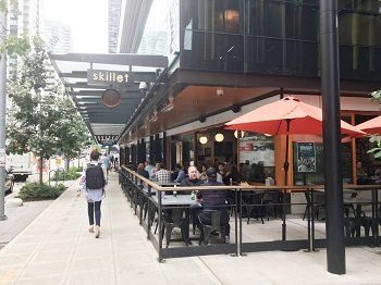
Residents in marginalized communities are likely to be concerned about gentrification and the possibility of their families, neighbors, businesses and cultural centers being displaced. Seattle has developed a map of displacement risk as well as relative access to opportunity that can help planners communicate about those concerns and the city’s potential policy responses. Seattle also has commissioned an outside analysis of the racial equity implications of the growth strategy the city has pursued for 25 years. “We think this is a critical starting place to have meaningful discussions with neighborhoods,” Hubner said.
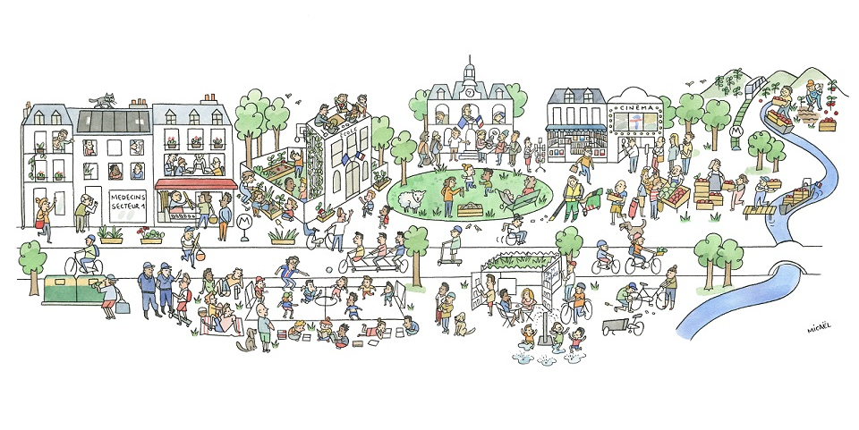
Cities should plan on maintaining community relationships through many years of implementation.

Cities should plan on maintaining community relationships through many years of implementation. Because the 15-minute city idea is as much about building connectedness and belonging as it is about buildings and streets, city officials should encourage and support collaborative community projects such as gardens, shared nonprofit spaces and volunteer opportunities, Chartier said.

Consider a Grand Gesture Toward People-Friendly Streets

Many of the cities that have most enthusiastically taken up the 15-minute city challenge to create more walkable, climate-adaptive neighborhoods post-pandemic are building on big, bold moves toward people-friendly streets that have galvanized public support.

Barcelona made global news in 2016 when the city created a mostly car-free “island” by closing nine blocks to through traffic, creating what came to be known as a “superblock.” In the absence of fast-moving cars, the intersections then had the potential to become plazas or green spaces. In the wake of the pandemic, Mayor Ada Calau announced the city would create a much larger such zone for its core, 21 blocks in all. The newly created squares and the streets will be planted with trees to shade 16 acres of new green space in an urban oasis with 83 acres for quiet walking, free of car-safety worries.

To create more public, open space in its densest neighborhoods, “Paris decided to remove 50 percent of parking space in the street right-of-way,” Chartier said. “Now they are in consultation with residents about how to use the space.”

With the arrival of COVID-19, Bogota Mayor Claudia López added 52 miles of bike lanes to help people move around when transit use was restricted, a down payment on a four-year pledge to create 174 more miles of lanes for bikes, scooters and other mobility devices. The goal is for Colombia residents to make 50 percent of trips that way as the city creates more “30-minute neighborhoods”.

Zone for Walkable Density and Housing Diversity

OK, you’ve taken the preliminary steps. Now comes the truly hard part for most American cities: Zoning reform. There’s no getting around the reality that putting daily needs within walking or biking distance of where people live means more mixing of shops and residences, and greater housing density in general. “To achieve the goals of a 15-minute city, each neighborhood should have a Main Street,” said Chartier. “Without a certain density you can’t make local shops viable, you can’t make transit viable.”

“A critical question is, ‘Do you have enough rooftops to support the things you’re looking for?’” Seattle’s Assefa said. “It takes 35-45 dwelling units per acre to support a corner grocery store of, say, 10,000 square feet, as well cafes and other local-serving businesses within a walkable distance.”

The rub, of course, is that most American cities and suburbs use zoning to segregate commercial uses from residential to a great extent. And the preponderance of land identified for housing is restricted to one dwelling per lot. In Seattle, whose mayor has declared an aspiration toward 15-minute neighborhoods, three-quarters of land designated for housing is zoned “single family,” effectively banning most rental housing. Seattle’s situation is more the rule than the exception among American cities.

Just as cities might want to start by creating pilot complete neighborhoods, they can begin the transition by promoting more housing within areas that are primarily shopping districts now, and by rezoning surrounding low-density areas to allow for multi-unit buildings of various sizes.

Neighborhoods that are making a transition from car-oriented to more walkable don’t necessarily need to start by adding high-rise, or even particularly large, apartment buildings, says Richards. “You don’t have to completely transform the form of the neighborhood to begin to add more housing options and the people that can support the businesses and institutions you want.”

She suggests starting by coding for what planners are calling the “missing middle”: House-sized buildings with multiple units, such as duplexes, four- and six-plexes and courtyard apartments. “Our neighborhoods often have the big houses — they are just limited to a single home, when it could be 3, 4 or 5. It’s about enabling more incremental development.”

Cities might also consider using an overlay of form-based codes in areas destined to become new walkable centers, Richards suggested. Rather than dictating the use of a building, form-based codes guide the placement, massing and features of buildings so that the sum creates a pleasant, active street. Establishing rules for the look and feel in conjunction with community discussions helps to codify what residents would like to see, which in principle could help them feel more comfortable with change.

Buildings within 15-minute neighborhoods might need to have multiple uses and flexible spaces — a municipal permit center some days of the week, say, and maybe a pop-up shop on other days. “We need to have a lot more humility about directing the uses of land and buildings,” Assefa said. “We have been discussing code relaxation for more flexibility to allow for reuses of buildings we haven’t anticipated before.”

Beyond Zoning: Incentives and Support for Local-Serving Retail

But zoning alone won’t make the optimal array of local-serving shops come to an area, nor help businesses owned by traditional residents stay afloat as rents rise or allow local stores to compete with online retail.  “Zoning can stop things from happening, but even when you have the zoning, it’s not clear whether things you want to happen will happen, without financial or other incentives,” Assefa said. “And you can’t be sure that the uses that come via the market will meet the needs or desires of the surrounding community.”

Nor will zoning changes necessarily reduce “the barriers people of color experience for them to be homeowners or developers, or commercial space owners,” he added.

In some areas, it will be important to develop public land, with local government creating the specifications for developer-applicants, Assefa suggested.

In other communities, such as Austin, Texas, the city provides an expedited permitting process and waives permitting fees for qualifying development, such as mixed-use developments.

Cities should plan on maintaining community relationships through many years of implementation.

“You can regulate the rent to make sure that smaller, essential shops can be located in the neighborhood,” Chartier said. “Paris has developed a public-private partnership that is supporting local shops, focusing on underserved neighborhoods. They have been working on this for 10 years.”

E-commerce and on-demand delivery “are a big, big problem” for local-serving shops, she added. Economic development officials in Paris are “trying to help smaller shops create ‘click and collect’ digital platforms,” so that customers can order online from nearby shops and pick up their goods down the street.

People-Friendly Streets and Public Spaces

As neighborhoods transition to become places where people can walk or roll for most or all of their daily needs, cities are weighing strategies to shift more street space away from the exclusive use of private vehicles. The goal is to create streets that not only are safer for people walking and rolling along and across them, but that also provide additional living space for urban residents, for strolling, dining, meeting, even gardening.

Strategies to do this could include requiring parking lots to go behind buildings rather than in front and adding or widening sidewalks where they are needed. Some cities in recent years have adopted a “complete streets” policy that attempts to address the needs of everyone who uses a street by adding sidewalks and bike lanes to city streets that have only accommodated cars. For cities looking toward 15-minute neighborhoods, that policy will need to be augmented by capital budgeting that actually devotes real money to those goals.

In response to social distancing and stay-home orders during the pandemic, many cities closed some residential streets to through traffic and turned them over to strolling and recreation. Some are now considering making many of those changes permanent. Seattle already has declared that 20 miles will continue in operation indefinitely, with other streets are under consideration.

Fifteen-minute city proponents point to schools as the heart of the complete, walkable neighborhood. To encourage parents to walk kids to school rather than drive, provide more play and outdoor classroom area and a safe space for parents, family and kids to interact during the pandemic, Paris took steps to create calm, traffic-free “school streets.” The French version echoes a longstanding program of Safe Routes to School in the United States, which could provide a model and potential funding for cities as they implement 15-minute principles. In Paris and in some U.S. cities, school yards have been opened to the broader neighborhood outside of school hours and made available for community gardens.

Greening dense, urban areas is imperative if 15-minute cities are to succeed, not only for the human spirit and the sake of the climate, but also for economic benefit. Assefa cited studies showing that streets with significant tree canopy out-perform those without. A researcher at the University of British Columbia has suggested a 3-30-300 rule for urban trees: Each person should be able to see 3 trees from home, in a neighborhood with 30 percent tree cover and 300 meters (roughly 1,000 feet) from the nearest park or green space. Achieving that level of greenery will inevitably require planting on a substantial share of the public rights of way that are now paved.

If you’ve made it this far, congratulations, you’ve just gotten started on creating a 15-minute city! All kidding aside, though it will require years of time, attention and investment, but the result should be a more livable, equitable and resilient city, for all who live there, Assefa said. “This is an incredibly critical time to learn lessons from a pandemic, rising awareness around race and equity, and climate imperatives,” he added.  “We can expect future pandemics and lockdowns, even as our cities and suburbs add more people. This approach is becoming more and more important. In fact, it’s vital.”

Source: “Implementing 15-Minute Cities: Where to Start?“

Filed Under: All News

The 15-Minute City

April 30, 2021 by CARNM

Old-Fashioned Compact, Convenient, Mixed-Use Development for a Modern, Post-Pandemic, Walkable World

The 15-minute city harkens back to an era when the predominant mode of travel was by foot and people could meet most of their needs within a 15-minute walk of their residence.

Illustration: 15-Minute City‘

The concept, introduced by Colombian-French scientist Carlos Moreno and being rapidly implemented by Socialist Paris Mayor Anne Hidalgo, has taken root in many urban areas around the world — including the United States.

In rapidly growing and urbanizing Charlotte, N.C., it’s the 10-minute neighborhood. In Louisiana, with more small and medium cities spread out and developed to suburban standards, the goal is the 20-minute neighborhood.

Whether the goal is focused on increasing a mix of uses and amenities citywide or in key neighborhoods, the 15-minute concept emphasizes meeting all needs on foot, via bicycle or by using public transit.

Because areas that are amenity-, activity- and transit-rich tend to become very expensive to live and work in, many cities are grappling with how they can ensure equity, inclusion and accessibility in these economically-powerful zones. See the “Inclusion, Equity And Accessibility — Ensuring The 15-Minute City Serves All” article.

The 15-minute concept emphasizes meeting all needs on foot, via bicycle or by using public transit.

For decades, smart growth policy, the movement of New Urbanism and other policies have tried to steer cities away from the high cost of sprawl and car ownership. The pandemic has accelerated the trend toward creating more pedestrian and bike space, ensuring each neighborhood has open/park/recreation space and greening streetscapes and more to create a healthier environment that fights obesity and other diseases contributed to by car-dominated lifestyles.

The rapid response needed to cope with COVID-19 has given many urban cores the opportunity to quickly convert traffic lanes into pedestrian-bike space. To cope with social distancing while preserving main street businesses, the transformation has often been at a warp-speed pace — compared to the usual array of public hearings and months of review by myriad agencies.

“Using only paint and screw-in markers, nearly 100 miles of Parisian roads were temporarily reallocated to cyclists in the early months of the pandemic — a revolution in urban reprogramming. It was later announced that the changes would become permanent,” wrote Carlo Ratti, co-founder of the international design and innovation office Associati and director of the Senseable City Lab at MIT, and Richard Florida, professor at the University of Toronto’s School of Cities and Rotman School of Management in Project Syndicate.

Moreno, father of the 15-minute city and Hidalgo’s special envoy for smart cities, is scientific director and professor specializing in complex systems and innovation at Paris – Panthéon Sorbonne University.
“Cities should be designed or redesigned so that within the distance of a 15-minute walk or bike ride, people should be able to live the essence of what constitutes the urban experience: to access work, housing, food, health, education, culture and leisure,” he said in an exclusive interview.

Moreno has four guiding principles of the 15-minute city:

  1. Ecology: for a green and sustainable city.
  2. Proximity: to live with reduced distance to other activities.
  3. Solidarity: to create links between people.
  4. Participation: actively involve citizens in the transformation of their neighborhood.

“This is in the tradition of Jane Jacobs,” Moreno said of the legendary urban activist-author who published “The Death and Life of Great American Cities” in 1961. “She developed this idea for livable cities — very vibrant, with green public space, social uses, different activities. The internet, technology and economic system is very, very different than her times, but this is still relevant today.”

Moreno said people are living in hard times of a pandemic, job loss, income disparity, long commutes and other pressures. He said making cities more livable is the medicine for urban ills.

“I call this the new happy life, the happy city. It also is healthier because of a low-carbon impact,” he said.

While Paris, which developed long before the car was the primary means of transportation, already is a 15-minute city to a large degree — Moreno points out that it still benefits from turning parking lots into greenery, making traffic circles pedestrian and bike friendly, and decentralizing the city. That means more medical centers spread through the neighborhoods and affordable housing introduced into wealthy neighborhoods, so support workers don’t have to live far outside the center.

Moreno acknowledges that increasing the livability of a big city can add to housing woes. This is particularly true in Paris — where a one-bedroom, 600-square-foot apartment in the 11th arrondissement relatively far from the Notre Dame, the Louvre and Eiffel tower, still costs more than $1,000 per square foot.

He said Paris has committed to creating much more social housing, to allow people to age in place, to combat gentrification and to create rental properties for low-income workers. He said government also must take an active role in preserving mom and pop commerce, the low-rise density of the Hausmann architectural style, six-story city and the human scale of Paris.

Moreno said connectivity to the suburbs (which are much denser that those in America) will be boosted by Grand Paris Express, a $25-billion expansion of the century-old Paris Métro to be completed in 2030, and the system will have gained four lines, 68 stations, and more than 120 miles of track. Moreno noted that the lines will boost inclusion for people with disabilities, as all stations will be wheelchair-accessible. (Currently, only three percent of the historic metro is accessible.)

Anthony Breach, senior analyst at the UK-based Centre for Cities, has some concerns that the 15-minute city is unrealistic in terms of thinking there ever can be enough affordable urban core housing for the millions of people working hard at jobs that don’t pay well.

“People live in suburbs not because they are stupid, but because of cheaper space outside the city center. If you force them to own within 15 minutes of where they work, they are priced out,” he said. “If you discourage commuting from farther out, their economic opportunity is cut off.”

Breach said he is skeptical that urban planning alone can produce equity. He said not all good jobs can be available to all people within a 15-minute walk or bike ride. Breach said if car congestion and pollution is the problem, vehicles and driving could be taxed at a higher rate and transit could be expanded by making it more profitable — via land development rights around stations.

Charlotte, consistently one of the fastest-growing cities in the United States, is creating the 2040 Vision Plan — a comprehensive approach to land use, transit, diversity, equity and dozens of issues related to a city of nearly 900,000 that is predicted to swell in population by upwards of 400,000 residents in the next two decades.

Taiwo Jaiyeoba, assistant city manager and director of Planning, Design and Development, said Charlotte is focusing on the 10-minute neighborhood.

A 15-minute city means more medical centers spread through the neighborhoods and more affordable housing.

“We’ve got right now a zoning code that is 1,000 pages. We want to reduce that number, so you can read the comprehensive plan and understand (the focus on) creating 10-minute neighborhoods,” he said. Some will have less density, some higher density — but regardless of where you are, you will be able to walk to different things such as childcare, schools, healthcare, jobs, services that meet daily needs.”

Charlotte is focusing on the 10-minute neighborhood.

Jaiyeoba said there are parts of the city focused on innovation, health care and manufacturing that need more housing developed close to them. It’s a move away from 20th century planning where residential was separated from commerce and job centers.

Charlotte’s CANOPY REALTOR® Association is working with city staff and elected officials to help guide the 2040 plan. CANOPY, which is working with several Charlotte builder and commercial REALTOR® groups, has stated “while we support many of the concepts being proposed, we are concerned about the costs and the impact of unintended consequences.”

CANOPY President David Kennedy, a property manager at T.R. Lawing Realty, said the 10-minute neighborhood concept could be helped greatly by reprogramming retail space.

“Retail, already hurting because you can get everything delivered, has taken a hit from the pandemic,” he said. “I think this is an opportunity for commercial brokers to turn a lot of retail space into mixed-use with multifamily. A lot of affordable, workforce housing could be built on the footprint of vacant retail. You just need to be creative and mindful of not clustering affordable housing. You want to mix in affordable with market rate, so everyone benefits.”
Jaiyeoba said the city is fortunate to have 19 miles of light rail, where people can commute without owning a car. He said about half the corridor has good connectivity to stations, but more can be done with trails and sidewalks to improve transit access for all.

“We must calibrate our sidewalks to make sure they are not only wide enough to accommodate people who use wheelchairs, but complete — as in they don’t stop short of the destination,” he said. “You cannot have a series of 10-minute neighborhoods and promote walkability, if there are obstructions in the sidewalk or there are gaps in the sidewalk.”

“We have more than 10,000 people who are visually challenged. If they have to cross six or eight lanes of traffic, think how difficult and dangerous that is,” Jaiyeoba said. “You have to think of pedestrian safety, of connectivity for those who use a wheelchair for mobility, for those who do not have access to a vehicle — that is who you design your city for.”

Jaiyeoba said the city’s 2040 plan is founded on an Equitable Growth Framework.

“Like many American cities, Charlotte was not immune to redlining and segregation by zoning laws,” he said. “Our current makeup as a city is defined by this very thing. We refer to it as the crescent [arc] and the wedge. The wedge [South Charlotte] is where the predominantly white population lives.”

He said that area has the best schools, well-designed neighborhoods, plus the best-paying and highest number of jobs outside of Uptown Charlotte.

“The arc is where most black, brown and low-income communities live. It has the lowest life expectancy, lots of industrial uses and [least amount of] tree canopy,” he said, noting the 2040 plan has built-in metrics to measure the achievement of equitable growth. “One of the plan goals is achieving housing diversity through Charlotte, which means rezoning the city to allow different forms of housing everywhere including in the wedge. This means duplexes, triplexes and townhouses. While that would help achieve affordable housing goals, it also helps to undo the legacy of segregation.”

In Louisiana — where few parishes had master plans before Katrina, few cities developed in a compact pattern and there is virtually no fixed transit — the goal is the 20-minute neighborhood. The Center for Planning Excellence (CPEX), Louisiana’s only nonprofit planning organization, is leading the statewide effort to promote a higher quality of life through smarter decisions in the built environment.

CPEX teamed with REALTOR® groups throughout the state to do better block demonstrations.

CPEX has partnered with the NATIONAL ASSOCIATION OF REALTORS® (NAR) for about 15 years — when Katrina rebuilding launched. During the NAR annual convention in New Orleans, some demonstration block improvements were done to spruce up neighborhoods and set an example of the value of walkability.

“We have teamed with REALTOR® groups throughout the state to do better block demonstrations — transforming spaces to be more bike-friendly, more pedestrian-accessible,” said Camille Manning-Broome, president & CEO of CPEX. “In Mid-City Baton Rouge, this led to a $13-million-dollar road diet.”

Jeannette Dubinin, director of Resilience and Adaptation for CPEX, created the 20-minute bingo card, to help everyday people identify shopping, health services, schools and daily conveniences within a safe, 20-minute walk.

“We are always trying to have education and awareness around the good, bad and ugly around the built environment,” she said. “[Bingo cards] give families a chance to go out and evaluate on their own what kind of assets can they get to and not get to in 20 minutes. The pandemic highlighted the ability to do anything within 20 minutes. We landed on 20 minutes because we are a suburban community, like most of America.”

Manning-Broome and Dubinin both noted that COVD-19’s silver lining was the move toward healthy activity. “Bike sales were going up like crazy. Restaurants were taking over parking spaces and bringing tables outside,” Manning-Broome said. The 20-minute city creates lots of opportunities to redesign for healthier living.”

The 20-minute city bingo cards encouraged people to take pictures of obstacles and to advocate for local improvements.

“People found sidewalks that end in the middle of something — or sidewalks with curbs too high, or no ADA curb ramps, or trees and barriers in the way. You can have all the sidewalks you want, if they are not usable, they don’t work,” Dubinin said.

Dubinin said intersections are not designed for safe walking to run errands or to get exercise. She said the 20-minute city must calm traffic and make it easier for people to get around by bike, on foot and via wheelchair. She said it is counterintuitive to drive to a nearby park, but with dangerous design and unsafe crosswalks, many people do.

CPEX also encourages development with more density and mixed use. It helps communities with land-use analysis, changing land-use patterns and rewriting zoning codes. It helped create the Louisiana land use toolkit, with model ordinances.

“NAR provided a support grant to CPEX and all eight Louisiana executive districts for REALTORS®. There were tours and REALTORS® doing workshops to unveil this model ordinances book to mayors and planning commissions,” Manning-Broome said. “The ordinances put in place decades ago prevent getting around a city in 20 minutes, so the intent is to undo regulations that created suburban sprawl.”

Norman Morris, CEO of Louisiana REALTORS®, is proud of the long partnership with CPEX and REALTOR® associations in every region of the state to promote building smarter, more walkable and accessible neighborhoods with a mix of business and residential.

“People want to walk to stores, shops and services,” he said of the value of the 20-minute neighborhood. “We target an area that needs some revitalization and improve a 4- to 6-block area. We clean up, paint, fix up storefronts — we create an atmosphere, an environment where [walking] can be done. It creates synergy, it enhances value of the corridor and the nearby residential.”

REALTORS® in Louisiana are working with key stakeholders to support complete streets and access for all. Morris said revitalization replaces blight and allows stores to stay open later — improving business revenue — because people feel safe on the street. The statewide association also received NAR grant support to create a toolkit for building better, especially in coastal areas to adapt to climate change.

From a developer’s standpoint, the 15-minute city makes sense to Two Trees, a Brooklyn-based, family-owned real estate development firm.

“The secret of placemaking is understanding what the local community values and how we can help infuse those values into the neighborhood and be real partners to our neighbors. To create a truly authentic place, you have to involve the community to gather input on what they need and want for the health and longevity of their neighborhood,” said David Lombino, principal at Two Trees. “We’ve worked to keep the human experience at the forefront of our work, always thinking about the social power of the built environment.”

Founded in 1968, Two Trees is best-known for transforming an aging waterfront warehouse district into the DUMBO arts and tech hub in Brooklyn.

“Domino Park, along the Brooklyn waterfront in the Williamsburg neighborhood, which Two Trees financed, constructed and operates, embodies this type of approach. In designing the six-acre waterfront park, we held dozens of community-based meetings and feedback sessions so we could understand what the local community wanted in a new public space,” Lombino said.

“More recently, Domino Park has served as a critical place for New Yorkers throughout the pandemic with painted circles that encourage social distancing on the lawn, which received international recognition and became a replicable model for parks around the world,” he added.

Two Trees — which has developed a portfolio worth more than $4 billion, including more than 2,000 apartments — agrees that the 15-minute neighborhood must include affordable housing.

“Two Trees has generated approximately 400 high-quality affordable housing units in Brooklyn and Manhattan. We have an additional 500 affordable units in the pipeline at our Domino Sugar Factory redevelopment site, and another 260 proposed units at River Ring, a new project,” Lombino said, noting that low-income units are identical to market-rate apartments, have access to all amenities and do not have separate entrances. (A controversial feature in other developers’ projects.)

Lombino said Two Trees’ philosophy of diverse community building includes supporting local businesses, artists and community groups.

“We make a concerted effort to curate small businesses that suit neighborhood needs and make an intentional decision to not rent to chains that can pay top dollar. We also regularly partner with community organizations on local hiring and public art installations,” he said. “We take accessibility very seriously at Two Trees — all of our buildings are ADA compliant and the vision behind the construction of Domino Park was to create an inclusive, accessible open space for all.”

Strong Towns Senior Editor Daniel Herriges emphasizes that the 15-minute neighborhood saves cities the high cost of maintaining sprawl.

“It’s important to remember that the cost premium for compact, mixed-use neighborhoods is largely a function of artificial scarcity, he said. “Fifteen-minute neighborhoods, and the kinds of housing that work well in them, are not expensive to create or maintain. They often have high real-estate values only because they are very popular and we haven’t built enough of them in the last few decades.

Strong Towns is a nonprofit focused on strengthening the urban core while eliminating budget-busting sprawl development.

“A trend I expect will grow among cities changing their zoning to allow more missing middle and walkable urban infill development — the kind conducive to a 15-minute neighborhood — is that of building density or floor area ratio (FAR) bonuses into the zoning code specifically for affordable units,” Herriges said. “The current gold standard for this with small-scale development is Portland, Ore., which passed its residential infill program (RIP) last fall. An analysis conducted by the city in consultation with several small-scale and affordable housing developers, including Neil Heller and Habitat for Humanity, found that significant affordability benefits would be achieved by the policy the city ended up passing, which provides a sliding scale of allowed FAR for buildings between four and six units — if they provide rent-reduced affordable units.”

Cristina Garrido — director of Innovation for CitiesToBe, an urban platform powered by Barcelona-based Smart Cities Consultant Anteverti — said cites around the world are embracing the 15-minute concept, especially as a reaction to the pandemic.

Milan and New York are widening sidewalks, pedestrianizing streets and increasing bike lanes.

“Milan and New York, for example, are already widening sidewalks, pedestrianizing streets and increasing bike lanes,” she said, noting that Barcelona has converted parking lots into civic space. “The pandemic has accelerated a change that had to be done if we wanted our cities to be sustainable in a mid/long term. From now on, cities will be more people-centered, and they will have more public spaces allocated for people.”

Source: “The 15-Minute City“

Filed Under: All News

  • Page 1
  • Page 2
  • Page 3
  • Interim pages omitted …
  • Page 9
  • Go to Next Page »
  • Search Property
  • Join CARNM
  • CARNM Login
  • NMAR Forms
  • All News
  • All Events
  • Education
  • Contact Us
  • About Us
  • FAQ
  • Issues/Concerns
6739 Academy Road NE, Ste 310
Albuquerque, NM 87109
admin@carnm.realtor(505) 503-7807

© 2026, Content: © 2021 Commercial Association of REALTORS® New Mexico. All rights reserved. Website by CARRISTO